Friday, October 30, 2015

Wrapping Up Our Time in Lone Pine - Leaving the Sierras for Now

Nine days went by too fast, and if there weren't a wedding and a grandbaby to get to, we'd have extended our time here. 

Wednesday is another attempt at locating fish. Which means we find some more really awesome boulders and views and dirt roads....but no fish. I suggest we go look for rocks and see if fish show up.......

I lost my lens cap and thought maybe it was when we were at Eric and Laurel's campsite, so we start the day at Tuttle Creek Campground. No lens cap, and although there's water in the creek, it is too narrow, and moving too fast for fishing. The trees and brush are really thick as well. Since Bill left the machete in his other pants, there is no way to access the water.

From there we head east where the map looks like the creek is wider near Tuttle Creek Road. Maybe, but it's on private property :-( .

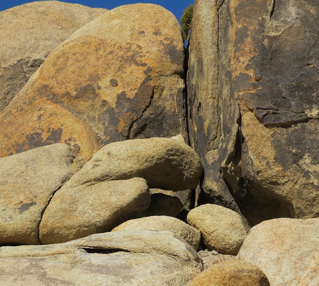
However the road itself is a wonderful surprise, curving tightly through steep cliffs of boulders. Unlike other areas in the Alabama Hills, this is a long, narrow canyon with rock formations on both sides. There's even a rock with a door in it. 


The door is no longer there, just a concrete frame and large chain - and little ghosts flying around the opening
The interior isn't dug out - it is a solid two-chambered rock "flow" of some kind - only goes back about  20 feet
I'm melting.....
Mountains of rock, not rock mountains - see, totally different!


The road takes us back to town, but we're not ready to go home, so we head north for Hogback Creek. We're nothing if not optimistic.


Green (for a desert), but no water
The abundance of greenery indicates water, but it's underground and the creek bed is dry. The Sierras look amazing with some cloud cover - looks like it's snowing up there - so we continue until we pick up Movie Road again.


Saving some Alabama Hills dirt for "later"
Another stop at our favorite Lone Pine restaurant, The Alabama Hills Cafe, for a late lunch, and we make our way home.

We join Dave and Sue at John and Pam's lovely (very!) home for our last happy hour (until our paths cross this winter), once again enjoying lively conversation and delicious hors d'oeuvres with these wonderful new friends.

Thursday the wind blows hard all day so we stay in and get things ready for travel day. Bill loads the "goes-in-the-Jeep" stuff, and after football we say good-night to Lone Pine - for this time.


Thursday, October 29, 2015

How Could We? How Did They?


Advanced, powerful, educated, progressive - America is all these things and more in 1942. So how could we do this to our own citizens? How could we ignore the Constitution, having spent the last nearly two hundred years holding it up to other countries as how they should govern? How could we?

Fear, bigotry, political pressure, lack of experience - the exhibits at the Manzanar Historical Site do an excellent job of presenting facts and information about this shameful piece of our history, without making excuses, without placing blame, without hiding responsibility. 

Homes, businesses, and their contents, sold for pennies on the dollar, or abandoned 
Japanese-American citizens, many born here, were rounded up by FBI agents and soldiers with rifles and "relocated" to one of ten centers. With only what they could carry, their lives were changed forever.

Moved from their beloved homes in the "exclusion" area to their new homes - relocation centers
While not the concentration camps of Nazi Germany, this was not summer camp either. Guns in eight towers were pointed in, not out. Fences of barbed wire, not white pickets, surrounded the center. Families were kept together, but in tight single-room-barracks (some relocation centers used painted horse stalls), not in homes with privacy and insulation.

Within the barracks blowing sand covered everything year round, temps reached over 100 degrees inside during the summer and near freezing in the winter
One major "uprising" in December 1942 was the result of a dispute between two factions of internees. Over 3000 marched on the administration center to protest the jailing of one of their leaders. Tear gas was fired into the crowd and ultimately gun shots killed one 17 year-old man and an older man died later in the hospital. This was not an attempt to escape.

In fact, there is no record of any attempted escape from Manzanar. 

Instead, they made the best of a really bad situation, and that is what I found most compelling about Manzanar. How did they survive the loss of their freedom, the betrayal of their country, the theft of their way of life? How did they?

Photos and recordings tell a story of sadness and regret, but also of creativity and having fun, of being productive, and even of being patriotic. 

Working in stores, serving on the police force, producing a newspaper, providing medical care, going to school, cultivating crops, building furniture - they made a life
Internees were "recruited" from relocation centers, and "allowed" to serve "their" country in segregated units that took heavy casualties.  They could die for their fellow citizens, they just couldn't live next door
Three high school classes graduated here, in cap-and-gown. Weddings, babies, competitive sports, theatre, music, art - all happened here. In spite of the ugliness of their circumstances, beauty happened here.

Manzanar is a desert - hot, cold, windy, barren. In the 20 minute film is a brief glimpse at the gardens that were built and planted and maintained and loved here. Of all I saw, this touched me the most. To make something so enchanting in such a harsh place, sings of the spirit of these people.


Peaceful gardens built in a time of war
Ponds unearthed from years of mud and blowing sand show the loving detail
Boulders selected for size, color and shape transformed this area into a beautiful and tranquil oasis
Rock as art in the small kitchen garden pond
We visited Manzanar with Dave and Sue, and John and Pam, adding intelligent conversation to the experience.  It is a sobering place, and I will visit again.

Surviving harshness by finding beauty - I think that's how.....


Tuesday, October 27, 2015

Portal to Playground

Once Pam let me know that Whitney Portal Road wasn't a dirt shelf I knew we had to return and finish the drive to the top. Monday is the day.

The handful of "no-guard-rail-steep-drop-off" corners and sections of huge rock slides (both the rocks and the slides are huge) aren't too bad, and the view across the basin is worth the couple of skipped heart beats. Lone Pine to the Portal is about a 4000 foot climb, and the last three miles are steep. Very glad we have coats with us as it is barely 50 degrees in the shade.

This is the staging point for hikers going to the Whitney Summit and the Whitney Recreation Area. In addition to the parking area, pit toilets, and bear boxes, there is a small store/kitchen that caters to the needs of hardy hikers and curious tourists.

The Portal itself has a permanent "starting/finish-line" feel to it, giving serious acknowledgement to what those who pass through it are about to undertake, and hopefully complete. 

High adventures await those who pass through this gate
Although there is very little snow on the peaks above, water is running strong down several creeks that all pass through the parking area. A large, beautiful waterfall at the back is reason alone to make the trip up here.


A few days earlier John and Pam, and Eric and Laurel, hiked the Whitney Portal Recreation Trail. We also hiked, walked, crossed the bridge, read the sign about the trail. It's very nice.

On the trail above the sign
The Sierras continue to amaze us every day. Whether in the distance coming back from Darwin, or at over 8000 feet in between their majestic walls - the power of these mountains is very humbling.


Ten miles back down the road and we have lost thousands of feet of elevation and gained 15 degrees in temperature. The rocks are no longer silver and gray, but brown and tan. Tall pines are replaced with low sagebrush.

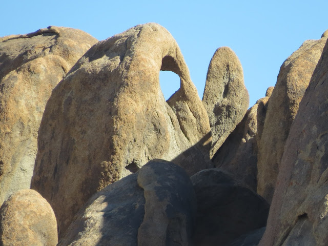
We're back in the Alabama Hills, ready to play among the rocks again. A lot less people on this Monday afternoon, we nearly have the place to ourselves. We explore the multiple dirt roads, around boulders and through narrow canyons. Access to several small roads has been closed with rock barricades and signs, so we turn around carefully and go a different way. In more interesting spots we get out and scramble a little, getting a different perspective on the wider views, and discovering hidden gems away from the roads. We even find some more arches :-) It is a most wonderful playground.

So many interesting combinations
Around the corner

The trail blazer
Whitney on a shelf
So many paths to explore
Big and tall Arch

Rock-fell-over-and-made-an Arch
Bad Photographer Arch
The-sun-has-to-be-just-right Arch
Slices of nutty bread
Dolphin
Raven
Being out in nature like this, feeling the power of majestic mountains, playing in big rocks - we are so blessed.

Love that this is our yard

Monday, October 26, 2015

Water Continues to Shape History in the Great Basin

This week we remember it's Saturday, and avoiding the Portal and the Alabama Hills keeps us from crowds on this hazy autumn day.

Years ago I visited the Mt Whitney Fish Hatchery north of Independence, CA, on my job with the union. I knew Bill would enjoy all the fish, and I remember it is a really beautiful location.


"Design a building to match the mountains, last forever, and be a monument for all time." MJ Connell, 1915
It is now a historic site, no longer a working hatchery. I feel bad that I didn't know the flood of 2008 wiped out not only the ponds, but Oak Creek that fed them.

I am happy to see the beautiful front pond is still here, as are the enormous Golden Trout for which the hatchery is famous. Bill is itching to grab a pole.


Volunteers with Friends of Mt. Whitney Fish Hatchery continue to maintain the hatchery grounds, a simple museum and interpretive center, as well as two indoor ponds, and a small egg collection and hatching operation. Because they are not a certified hatchery, the fish they raise cannot be released in any public body of water. Instead they stock their pond, and once a year kids younger than fishing license age are invited to come and fish all day - taking home what they catch.


Hatched to live their whole lives here
 We enjoy the exhibits and the movie, but it is the continued commitment by this little community that is really moving. The hatchery property was purchased in 1915 by citizens of Independence and given to the state of California. When budget cuts threatened closing the hatchery, the Friends stepped up and kept it going, and when the state deactivated the facility following the flood damage, they cleared the front pond, completed repairs, and reopened the hatchery as a historic site. They continue to work toward reactivation.


Planting fish with mules
Wonderful exhibit of local reptiles
Lighted photos tell the history of the hatchery
Mining claims map - thousands in every mountain range
Leaving the hatchery we drive west to find Oak Creek. In 2007 fire ravaged the mountains here, leaving the watershed bare and unprotected. The heavy rains of 2008 brought logs and rocks and tons of mud rushing downhill.

Oak Creek is only now beginning to carve a new path. The south fork rushes through concrete gates set up to direct the water through the devastated canyon. Walls of mud and rock cover miles of landscape with only a handful of trees in sight. 


Gates on Oak Creek help in restoration efforts
Beat up, but still standing strong.  And trees.


Large mud flows take the place of Oak Creek
Over five feet high, full of rocks and logs
From the road, the former route of the north fork is defined by a dark line down the hill, while a thin green new route runs a few miles north.

Eight years later the level of destruction still visible here is a sobering reminder of the terrible power of rushing water. 

I want to see the extensive collection of Owens Valley Paiute and Shoshone baskets at the Eastern California Museum, also in Independence. While this sounds as appealing to Bill as oral surgery, he enjoys the local history exhibits with me.


Includes 25,000 photos covering over a 100 years of local history
Much of the area's history is shaped by the water wars
Los Angeles as the "good neighbor"
A large exhibit about Clyde's mountaineering makes me want to read more about him
Museum humor :-)
An author is giving a presentation with slides in the corner of the Anna and OK Gallery, and the lights are turned off. I have to use my cell phone flashlight to see the collection. Definitely "different", and a good excuse for Bill to take Tessa outside.


The story-teller baskets are my favorites
It is a large and beautiful compilation, including bead-work, arrowheads, and blankets. Even without proper lighting, I appreciate this opportunity.


100-year-old beaded straps
The small desert garden outside is suffering from the extended drought, but it is a pretty site, nicely maintained.


Mary DeDecker Native Plant Garden
Again we've seen things on our list, as well as new surprises we never expected.  It's why we love taking our time in our travels :-)