Trinidad, Colorado
In addition to her campground review, Lisa also posted about the Highway of Legends, and I know we have to see it. Hoping the predicted thunder storms will hold off, we head out on the 120 mile loop.
There are 21 identified points of interest, and we're staying at number three. The town of Trinidad, and the history museum downtown are points one and two.
Cokedale is a few cute old homes, a fire station, church, community center, museum, and the interesting ruins of coke ovens once used for turning coal to coke (used for smelting iron). Looking like a single row of Roman ruins, the symmetry of the structures is impressive.
 |
| Cokedale coke ovens, Hwy 12 |
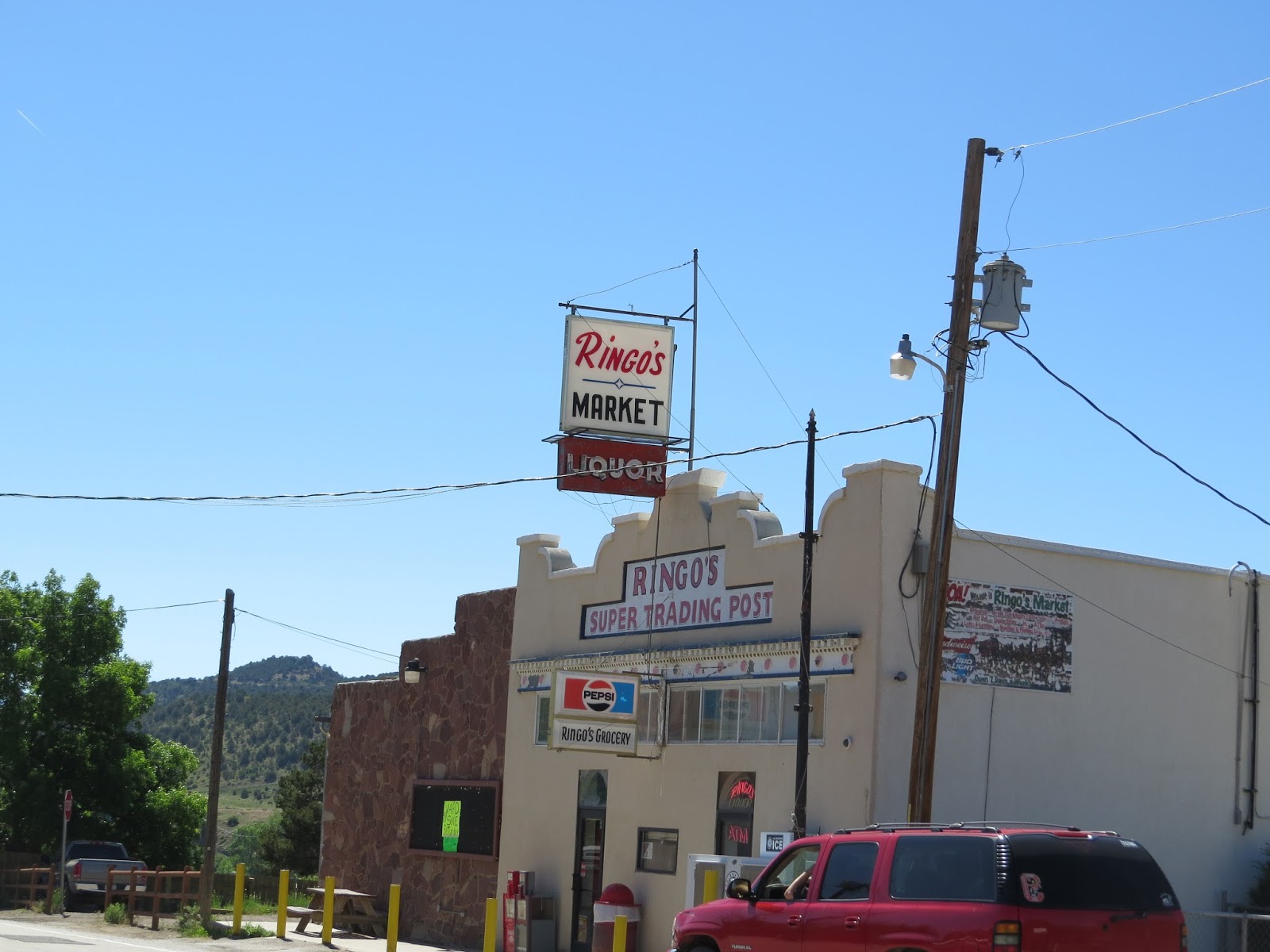 |
| Segundo business district |
We miss the bridge house in Vigil :-), but fall in love with the little burg of Stonewall. This whole valley is stunning with the snow capped Rockies in the distance, and meadows full of green grass and wildflowers. Here the 250 ft high Dakota Wall adds another spectacular dimension. The entire commercial enterprise of Stonewall is for sale, and includes a market, restaurant, cabins, liquor store, outfitters, and four RV spaces.
 |
| Now a peaceful retreat, Stonewall has a contentious history of battles between early settlers and land-grant heirs |
 |
| I have to remember this is covered in snow many months of the year |
 |
| Pretty homes spread out over the valley |
 |
| Dakota Wall, Stonewall, Colorado |
 |
| You could own this.... |
 |
| Monument Lake has a small resort with cabins and a small store |
 |
| North Lake has minimal access from a primitive day use area |
Except there's this nice dirt road that goes to Cordova Pass. Just six miles up.
And up.
Fortunately it is a fairly wide dirt road with large trees "covering" the steep drop off on one side. Unfortunately I'm feeling the higher elevation in a not-so-good way, and by the time we reach the summit Bill is feeling it too. Tessa thinks we're wusses.
 |
| The first mile lures you in, before the rocks and ruts laugh at you the rest of the way |
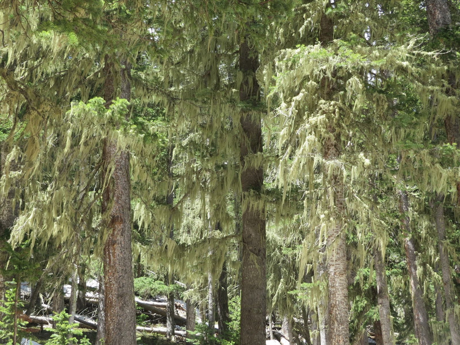 |
| Spanish Moss near the summit |
 |
| Still deep in some places |
 |
| because we're at a gazillion feet |
 |
| Just to the left of center |
 |
| the little resort of Cuchara |
Lunch at Timbers is delicious but I feel like I'm underdressed in shorts and a t-shirt. Not sure where all the folks in slacks and skirts drove in from....maybe they're all headed to the same wedding.
 |
| Timbers in Cuchara is a nice half-way point for lunch |
 |
| The Aspens still wear their fresh spring green |
Tessa and I walk around a bit, read a bit, and after about 40 minutes Bill returns.
 |
| Like the river nearby, this creek is fast and full |
 |
| Man in his heaven |
 |
| A peek of creek below the snow |
 |
| Furry orange rock......Broncos territory |
 |
| The storm begins to build in the distance |
 |
| while Tessa embraces her Mountain Mutt |
 |
| along a lovely creek |
 |
| with blue skies overhead |
A few miles later, and not listed on our map, is a crazy wall of what look like very loose rocks.


 |
| Hours later, as the thunder is shaking the motorhome, I wonder if these are still standing?! |
 |
| At 4:30 the sun makes it impossible to capture the "steps" side of the dike. Still, it is amazing from all directions. Spanish Peaks in the background. |
La Veta is a quaint, artsy little town that looks like a fun place to explore. There are two RV parks that both look completely full of travelers. We'll have to check it out next time as the skies are getting dark and dopler is showing the storm moving toward us.
We drive through Lathrop State Park, which is another very nice park with electric sites and plenty of space. It is about 10% full on this Sunday afternoon.
Points of interest 19 and 20 are a golf course and the old coal town of Walsenburg. The golf course is green and the town is about half the size of Trinidad, but we don't need to stop for either of them.
The final point is the Ludlow Massacre Memorial which we don't see. It is a sad piece of local history commemorating the confrontation between 10,000 miners and state militia. Obviously from its name, many were killed.
The highway returns us to I-25 at Walsenburg, and the 40 mile drive back to Trinidad completes the loop.
There is so much beauty and history to enjoy on this drive, I strongly recommend taking a day to see it when you're in the area.
I have been craving Chinese food for months and we finally find a not-the-scary-buffet-with-funky-smells restaurant in Trinidad for dinner. Wonderful House has a nice selection of standard and specialty items.
The storm holds off just long enough for us to get home, and then we have about an hour of delightful rain, lightning and big booming thunder.
Maybe it will wash off the motorhome!
 |
| Our nearly empty campground getting a nice soaking |
What a fantastic loop! Love the mountain lakes and that elevation...bring on the cool temps!! Devil's Stairsteps is so neat. So glad to see a photo of Bill at his happy place finally:) Tessa looks very content in the deep green grass:) Thanks goodness the furry rock was Bronco orange and not that yellow color!!! Sure sounds like another day in paradise:)
ReplyDeleteIt is such a great drive - with something for all of us :-) Knowing you've been in a lot of heat lately, I'm just going to ignore the yellow comment!!
DeleteYour description of the coke ovens looking like a single row of roman ruins is perfect. You have some great pictures today. Love the first one at Monument Lake and the one at Farley point. Great pictures of the storm and the stream and the shot of the dike at the end is fantastic. Glad Bill got his catch but wouldn't they have made great dinner? Nice job of getting the predicted rain to wait until you arrived home.
ReplyDeleteThanks Sherry, it was a beautiful area to try and capture. We weren't prepared for fish transportation so fresh trout wasn't on the menu :-( It was like the storm was watching us - and gave us a break this time :-)
DeleteYou are so right that one must remind oneself that the area is covered in snow part of the year! Isn't this just one on of the most gorgeous places?!?! I feel that way about all of Colorado (that I've seen)...but the snow deters me from wanting to live there.
ReplyDeleteI'm so glad I read your post - ages ago, but had it saved - and it was all you said it was! All the pretty little valleys call me to live there, but I see the snow fences along the highway and come to my senses :-)
DeleteWhat a day...so much to explore and yes, some fishing time too. Colorful Colorado is amazing...
ReplyDeleteTessa sure seems to be enjoying herself! Sally would love all that green grass too!
I keep telling her she's missing all the views, but she's too busy reading every story in the grass. She finally looks up when she lies down for a bit :-)
DeleteLooks like a beautiful place to be. However, not sure I'd like that altitude or even looking down from it. Snow in the summer? That's more snow than we saw in Alaska!!
ReplyDeleteI don't know what I was thinking! I was surprised not only by how wide spread it was, but by how deep it still was in places.
DeleteSuch a great historical loop drive. Tess looks to be adjusted to being a mountain mutt and seems to deal with that elevation quite well.
ReplyDeleteOh yes, she seems to suffer no ill effects like her puny humans - which of course I'm very grateful for :-)
DeleteI really enjoyed this segment of your blog! With you being just one state over, I'll have something to look for! Tessa looks so relaxed and adorable as usual! Bill looks like he having lots of fun and relaxation.. :)) Great pictures.
ReplyDeleteThanks! Between Utah and Colorado you'll have lots to see close by :-)
DeleteI often have to remind myself that it rains 9 months of the year when we're enjoying our idyllic summers on Lopez Island! It's so easy to be seduced by beautiful places in their "perfect" seasons. :-) What a wonderful day of adventures you had on the loop drive. But you really must take along a little ice chest so that Bill can keep his catches! Trout for dinner.....yum!! (But Chinese was easier!)
ReplyDeleteWe have been so fortunate to have great weather every place we've been. The thunder storms have been wonderful after so many months of dry weather. The humidity is rough in Colorado Springs this week, but not too bad :-)
DeleteLooks like a wonderful drive, love love CO. Bill had better luck fishing than Dave did. Devil's Stairstep looks a lot like Devil's Slide in UT, such unique formations. The altitude in CO can get to you if you're not acclimated. We had the same Chinese hankering while still in UT, I think your restaurant was probably better than ours.
ReplyDeleteThat Devil was very creative :-))) We were considering Pike's Peak but now think we'll just enjoy it from the bottom. Chinese food in UT even sounds wrong!
DeleteIts a wonderful drive and thanks for taking me back there.
ReplyDeleteDuring our drive we went all the way to Great Sand Dunes National Park a long day :)
That is a very long day!! We spent nearly nine hours just on the loop! Someday we'll see the Great Sand Dunes :-)
Delete